A Fjord By Any Other Name
Tucked away at at the head of the Oslofjord, Norway's capital city is blessed with an embarrassment of natural riches. Strolling around town you find that the line dividing city from nature is often blurry, an arrangement which feels intentional given that nature walks are "part of the national soul." There's even a word - marka - that describes the dense forest that surrounds, and in the most benevolent way possible, ensnarls the city. Every which way you wander you'll find yourself within a short amble of forests, mountains, lakes, rivers, or the great Oslofjord herself.
While not a technically a fjord in the geologic sense, the Oslofjord falls under the loosely defined Norwegian concept of a fjord. If you go by the definition offered by Springer Reference's Encyclopedia of Estuaries, a fjord is "a sea inlet that has inundated a trough formed by glacial erosion, ranging in length from a few to hundreds of kilometers. Although troughs erode rapidly under glacial conditions, many fjords are erosionally complex, palimpsest features that formed over the course of multiple glacial episodes."
Furthermore, the "cross-sectional profiles of fjords can be described mathematically by empirical power-law functions or second-order polynomials."
I thought I was out but you pulled me back in, Encyclopedia of Estuaries. Well played.
To a Norwegian a fjord is, I dunno, like that water out there.
In Norway a fjord isn't defined. In Norway a fjord is a vibe.
If you're cool like the Norwegians and call it a fjord or lame like the geological technocrats and call it... a non-fjordian estuary?... the Oslofjord puts Oslo into the highest tier of my city rankings: Cities With Harbors. I just love myself a great harbor.
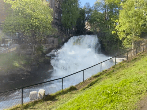
One of the more appealing features of the Oslofjord to a rugged seafarer such as myself are her scattered islands within a short ferry of the city center. During an afternoon walkabout on a notably delightful day the tousled mop atop my head becomes sentient and cries out for a zephyrous squall of salty air. I pause, first checking my thesaurus, then the ferry schedule, to find vessels running every 30 minutes in a loop of 5 islands - Nakkholmen, Lindøya, Gressholmen, Bleikøya, and (of course) Hovedøya.
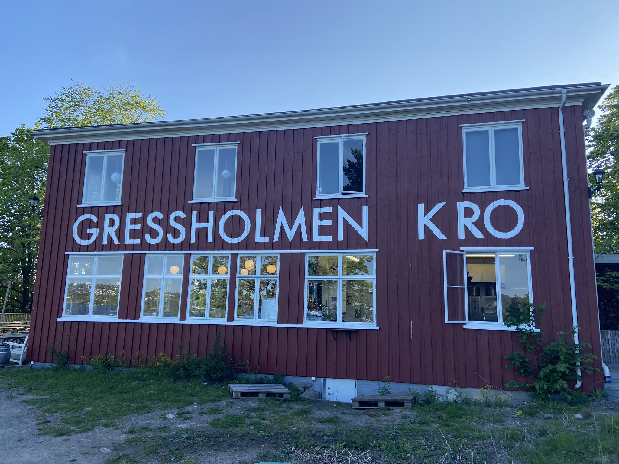
I make the short walk to the ferry terminal and hop on with my sights set on Gressholmen. According to my research there's a nice little cafe on the island that seems the perfect setting to soak up rays from the afternoon sun hanging high in the sky. 45 minutes and two stops later I find myself livin' on island time.
Once disembarked, I wander for about a mile of the 3 mile trail encircling the island and its nature preserve. The ramble works up an appetite and a little tingle in my throat that just might be alleviated by a light, crisp barley sandwich. I plop onto a bench on the patio at Gressholmen Kro, a picturesque cafe overlooking the fjord. I order a small charcuterie plate and wash it down with a Christiania Bryggeri pilsner. Just what the allmennlege ordered!
As I'm relaxing at the cafe I discover that this island was the location of the original Oslo airport. This revelation I find utterly preposterous until I find that it was only for seaplanes.
Which is an objectively Viking way to design an airport.
Nordic Cycle
The fjord lends itself not only to skirting atop the water; just as much fun can be had in the water. Lining the fjord opposite the Opera House & Munch museum sit a handful of saunas billowing the sweet smell of burning wood and affording the time honored Scandinavian tradition of hot sauna/cold plunge, also known as The Nordic Cycle.
Sondre suggests SALT, a self-proclaimed "cultural arena" with six saunas, six music stages, and indoor & outdoor bars. I meet him and Nora, along with Will and Anna, in the cultural arena's outdoor bar for a round of Aperol Spritzes before our schvitzes. We mustn't dally too long, since unlike the rest of the saunas we must be punctual if we want to take part in the ritual.
After downing our cocktails we check into the sauna facility and shuffle into a sauna room fashioned with three rows of tiered benches. Everyone takes a seat and the most aggressively beautiful woman I've ever seen in my life floats into the sauna with a bundle of accessories. She explains, in a slightly threatening tone, that the ritual will last approximately 10 minutes and under no circumstances will there be any talking.
After the announcements she turns up some hypnotic music and thus begins, what I now know is called, the aufguss. Our aufgussmeister (I also just learned that word) begins by passing around a container of ice from which I scoop a handful onto my head and neck.
From there our aufgussmeister cranks up the heat before theatrically spinning a towel 'round her head like a helicopter, distributing the heat with a mesmerizing pattern of steam and smoke. As the steam circulates through the sauna, our 'gussmeist pours a wooden ladle-ful of water & essential oils onto the sauna coals, releasing a plume of lung-invigorating steam into the air. She continues to fan the vapors, each revolution of her towel emitting a distinctive whoosh sound.
She continues by dipping a birch bough into a basin of water and spritzing everyone like a priest flinging holy water. We then sit in meditative silence for 10 minutes before she concludes the ritual by placing ice-soaked towels over everyone's shoulders.
After the ritual we head to the main sauna house, a 30-40 foot A-frame structure with rows upon rows of tiered wooden benches. We find a spot about 3/4 of the way up the room and let the hot air work its magic. After the recommended 20 minutes of sweating we emerge from the sauna with our sights set on the fjord.
With a quick, slightly worried glance among my co-conspirators someone calls out "ONE-TWO-THREE" and we all leap into the frigid, Scandinavian water. The initial jolt from the plunge is exhilarating. We tread water for a few seconds before scampering back to the ladder and the warmth of our towels. Refreshed, invigorated, energized.
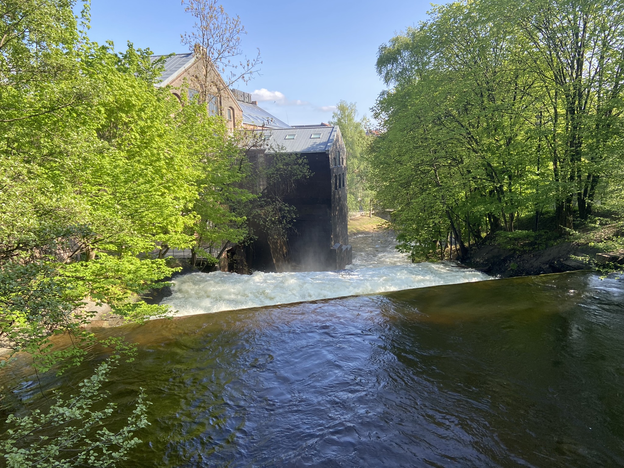
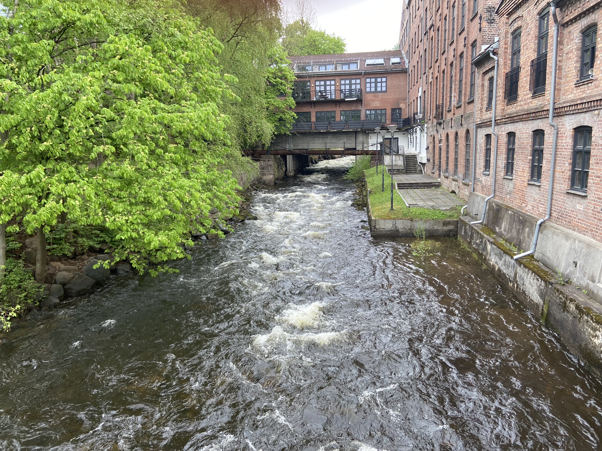
The Akerselva
In the days following the debauchery of Constitution Day, I decide to make a survey of the main confluence flowing through Oslo to the fjord. The Akerselva (Aker River) starts at Maridalsvannet (Lake Maridal), a natural freshwater reservoir perched above the city and its main source of drinking water.
Sondre's apartment sits approximately halfway from source to mouth; an athlete with sufficient gumption could leisurely round trip the entire length of the river in an afternoon. Seeing as I'm on holiday I decide to break it up into two separate days. Over the course of those two days I run about 80% of the length of its 5 mile course and its 500 ft elevation gain, which I think is a relatively admirable achievement all things considered.
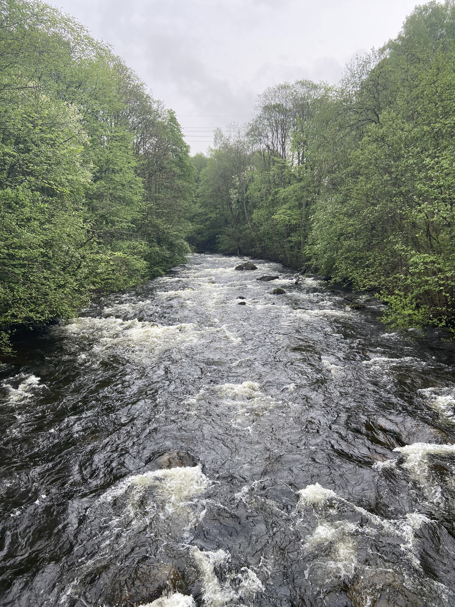
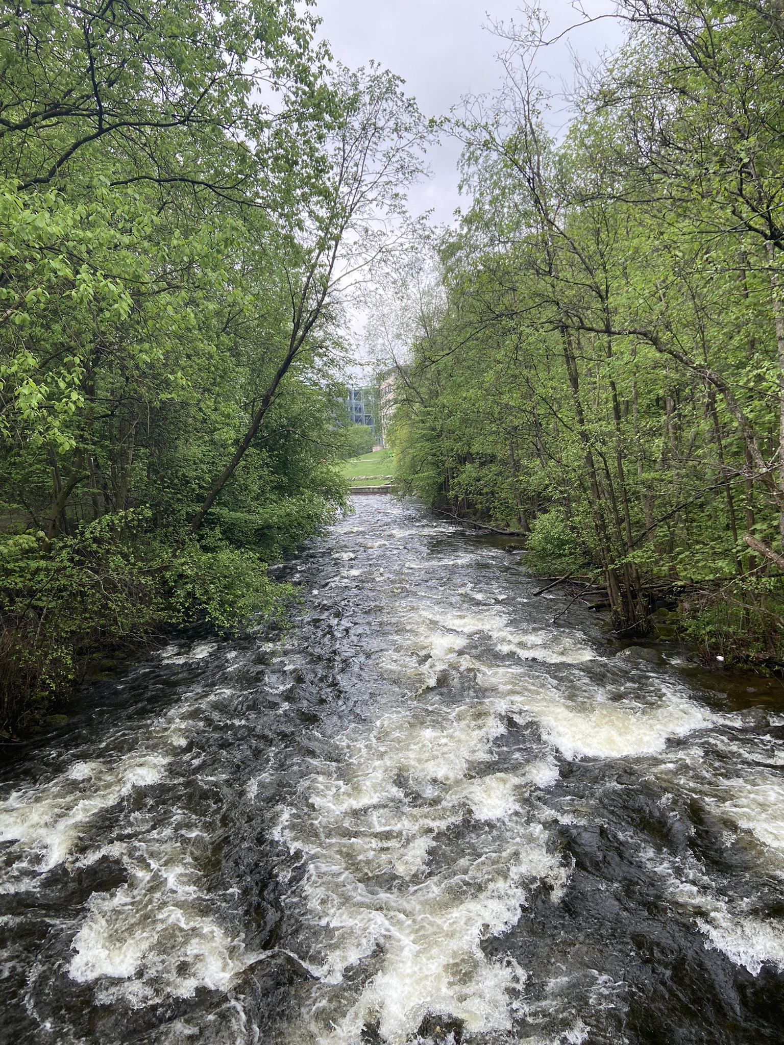
The Akerselva was once the manufacturing heart of Oslo, as evidenced by the scores of mills, factories, and other industrial-looking brick buildings along its length. By the 1970s the river was heavily contaminated from 150 years of unbridled industrial pollution, leading to an effort in the 80s to revitalize the health of the river.
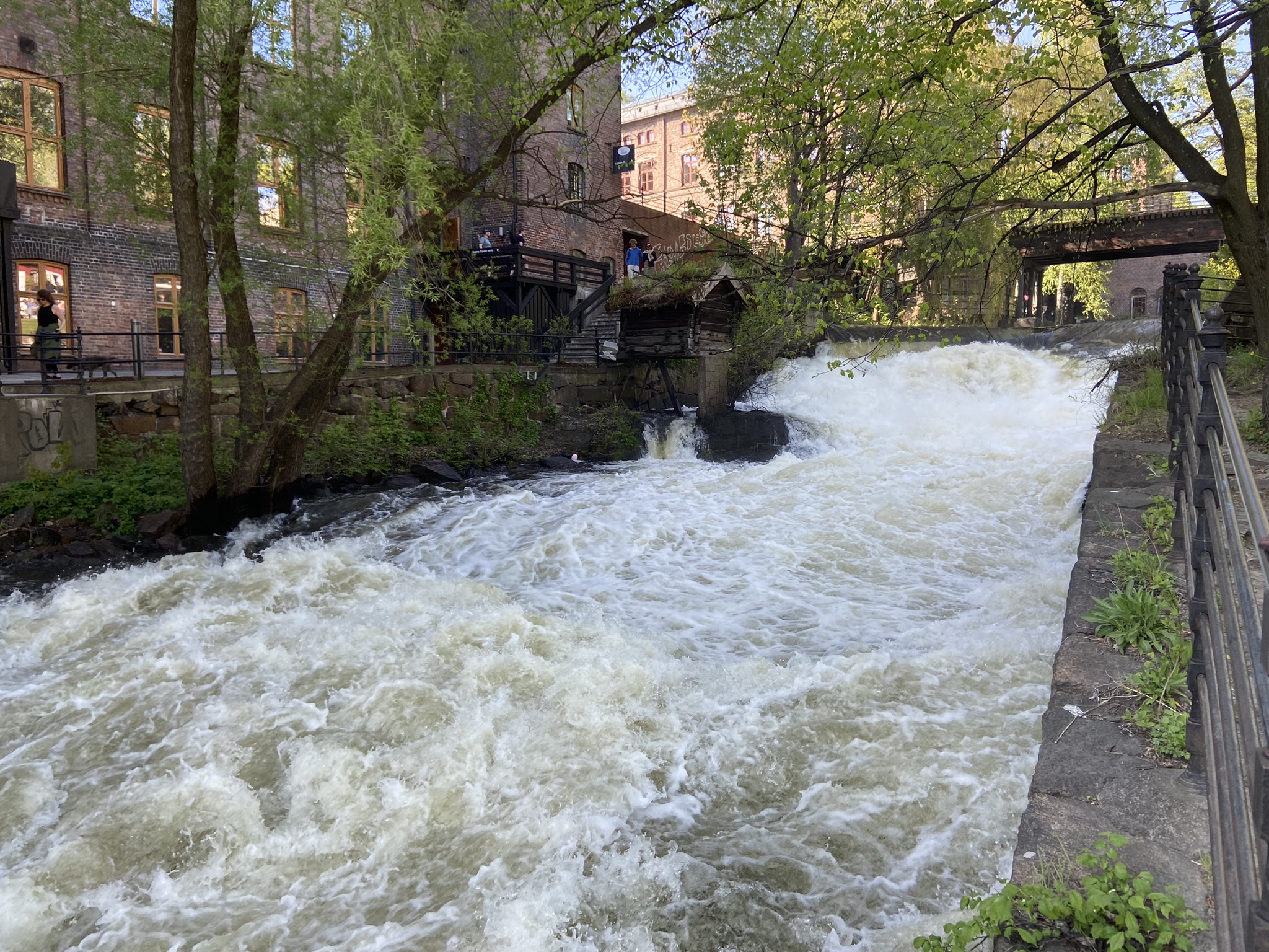
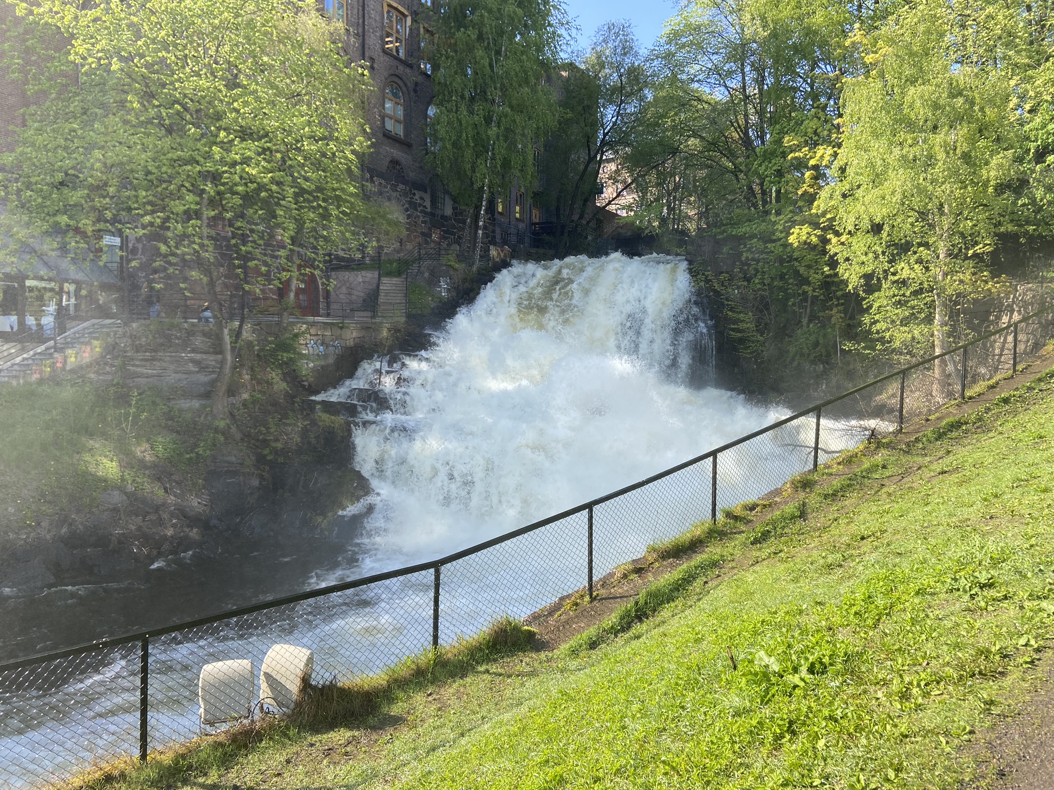
The initiative's success can be seen today through the river's diverse flora & fauna, none of which I could identify, mainly owing to the fact I can't read the Norwegian placards stationed along the walking path. In a win for the environment and every living creature in the Akerselva river valley the entirety of the river has been converted into an eco-park, transforming many of the industrial buildings into restaurants, shops, bars, and lovely attractions for Oslofolk to enjoy on a beautiful May day.
Gausta
"I don't know if you have other plans but we can go skiing tomorrow if you want. We have a cabin up in the mountains."
~closes laptop in the middle of making plans for Stockholm tomorrow~
"Nope, no plans."
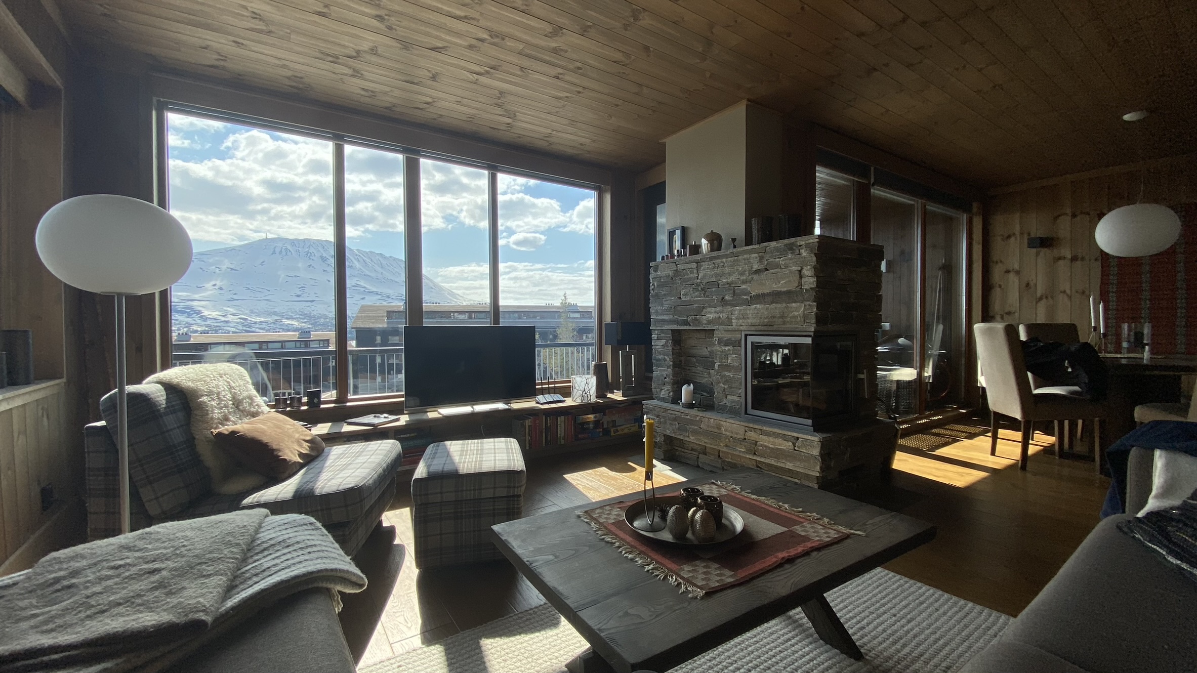
As it happens the phrase "we have a cabin up in the mountains" turns out to be the height of understatement. Sondre may have said "condo" whereas I heard "cabin", but whatever the appellation deemed appropriate for the accommodation I was not prepared for this:
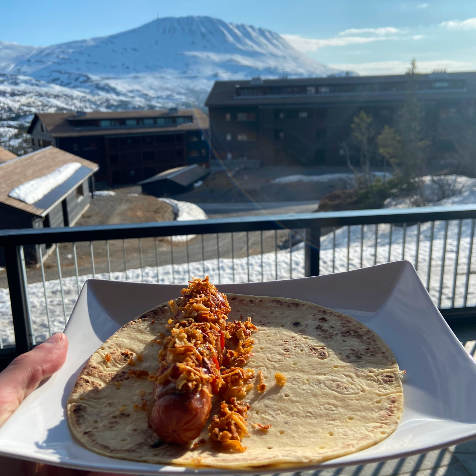
The 3 hour drive to the mountain begins as any good road trip does: a pit stop for coffee and nonsense snacks at the first gas station we encounter as we reach the amorphous region known as the edge of town.
I've previously discussed nutritive technology on this soapbox before but at this gas station I once again meet a Norwegian culinary innovation that must be praised.
If we were to pit nonsense snacks against each other in a European-soccer-style hierarchical league system, a system which we could perhaps call the Syndicate of Nonsensical Aliments, Comestibles, Canapé, and Sustenance (SNACCS), this treat would roost confidently in the top flight year after year after year.
With no fear of relegation, the Norwegian Gas Station Waffle would sneer at Slim Jims, laugh in the face of pork rinds, cackle at the thought of pretzels.
Pretzels?? Pretzels?? We talkin' bout pretzels!!??
The Norwegian Gas Station Waffle nods respectfully at giant dill pickles in a bag.
The Norwegian Gas Station Waffle doesn't even acknowledge gummy candy.
The Norwegian Gas Station Waffle is a soggy surface-impressioned-leavened-batter-bread filled with whatever conceivable edible morsels a maniac in charge of such things sees fit. In my case the soggy waffle is laden with butter, mystery-berry jam, and brunost.
It's mealy, it's flaccid, it's repulsive.
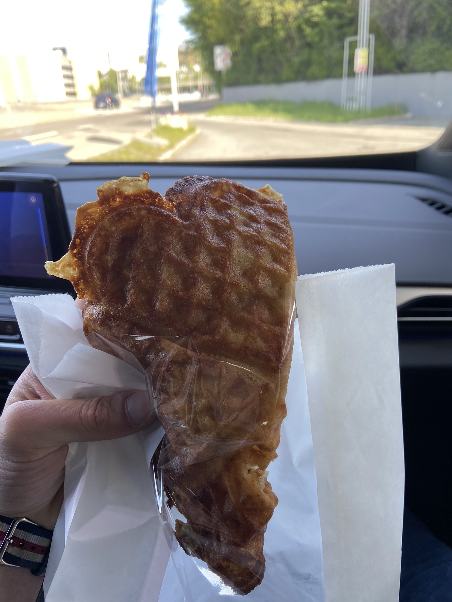
It's exactly what I want.
My pilot and I scarf down our roadwaffles with a steamy helping of brown water masquerading as coffee. The first hour and a half of the drive is a tranquil jaunt through the idyllic rolling hills of the Norwegian countryside.
We see bridges
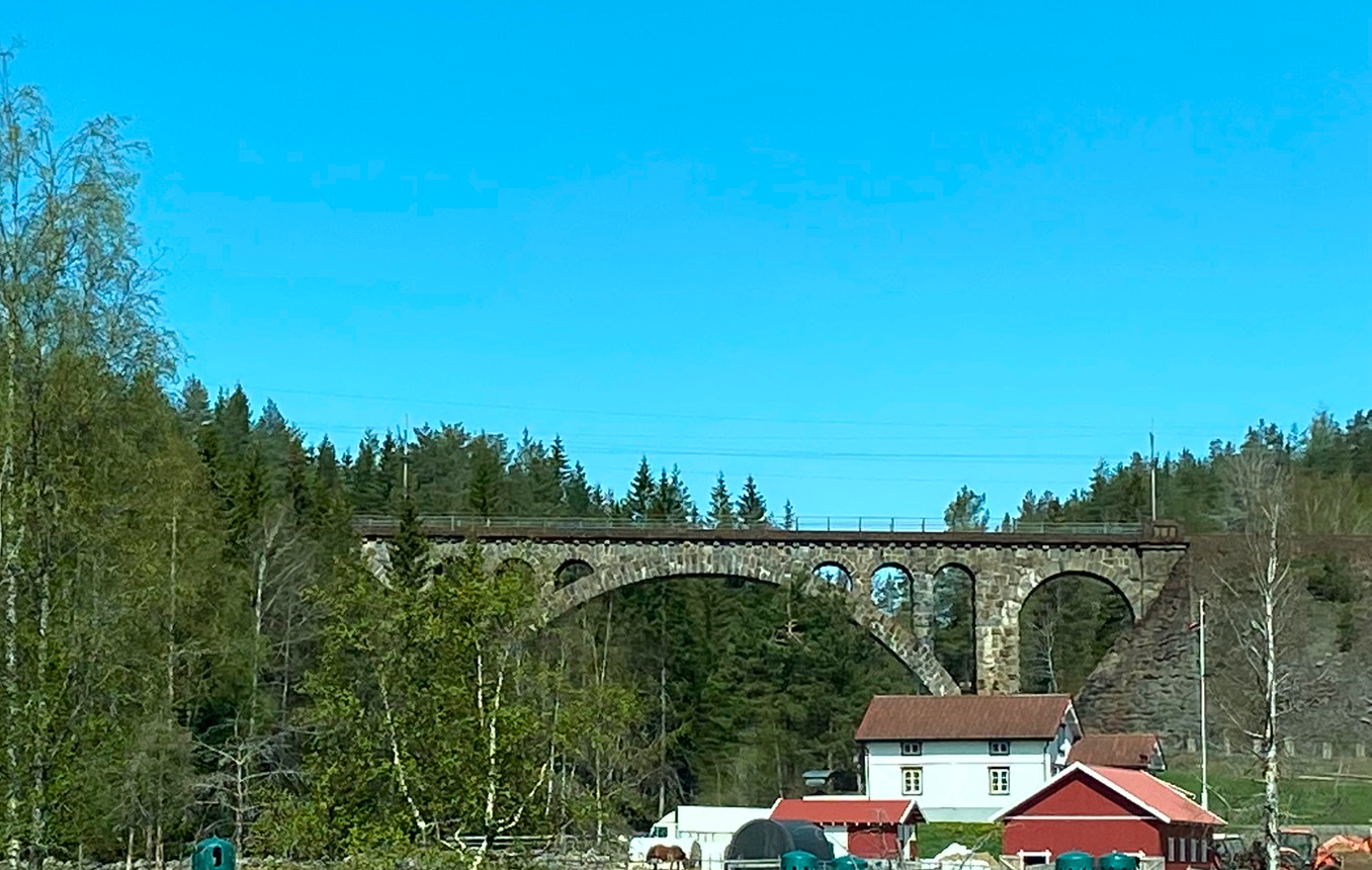
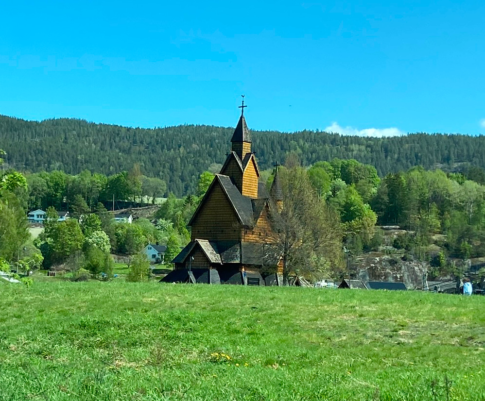
We see stave churches
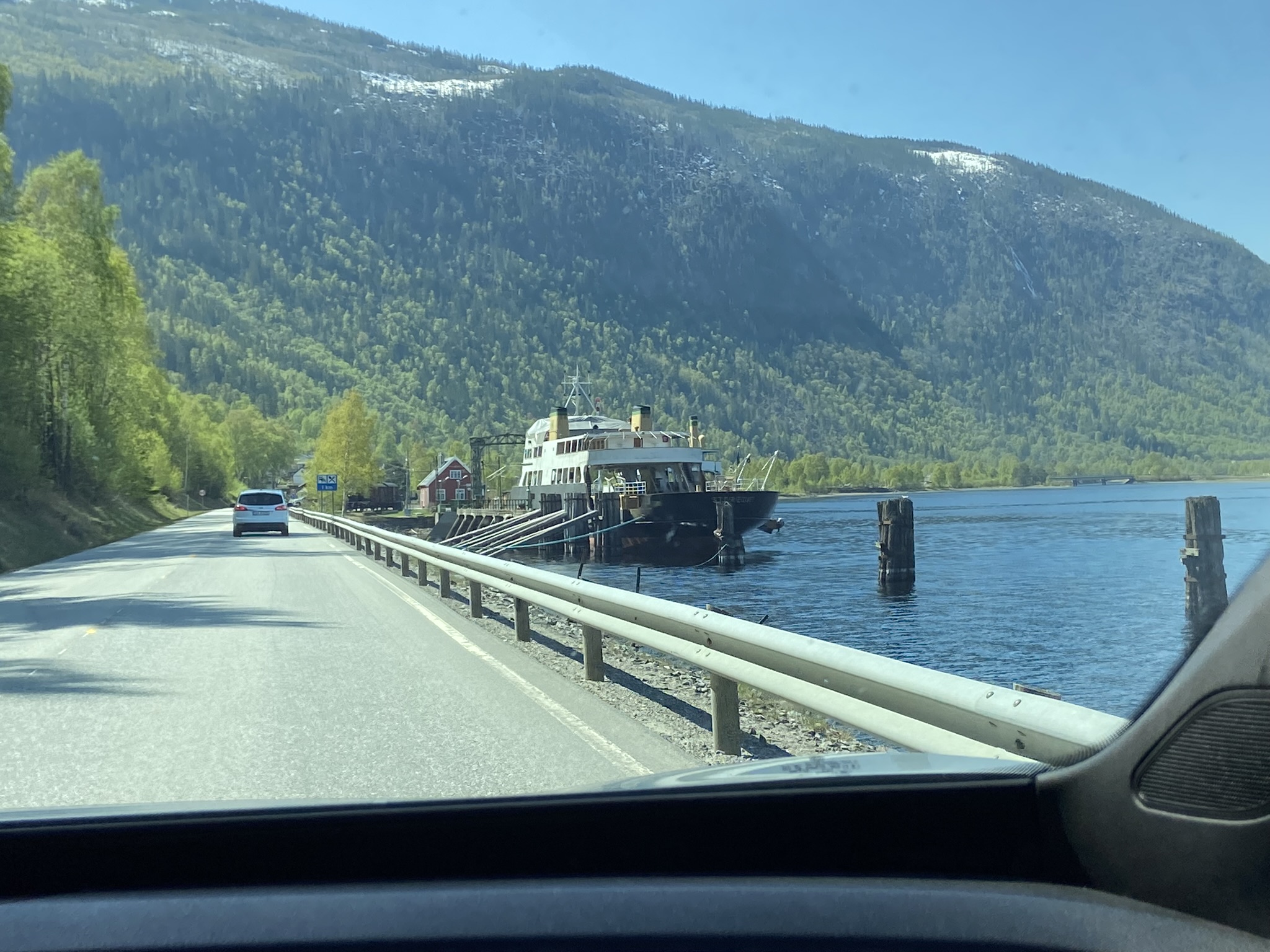
We see WWII ships
And then as we round a bend, we see the immense protuberance of Gaustatoppen appear between two mountains
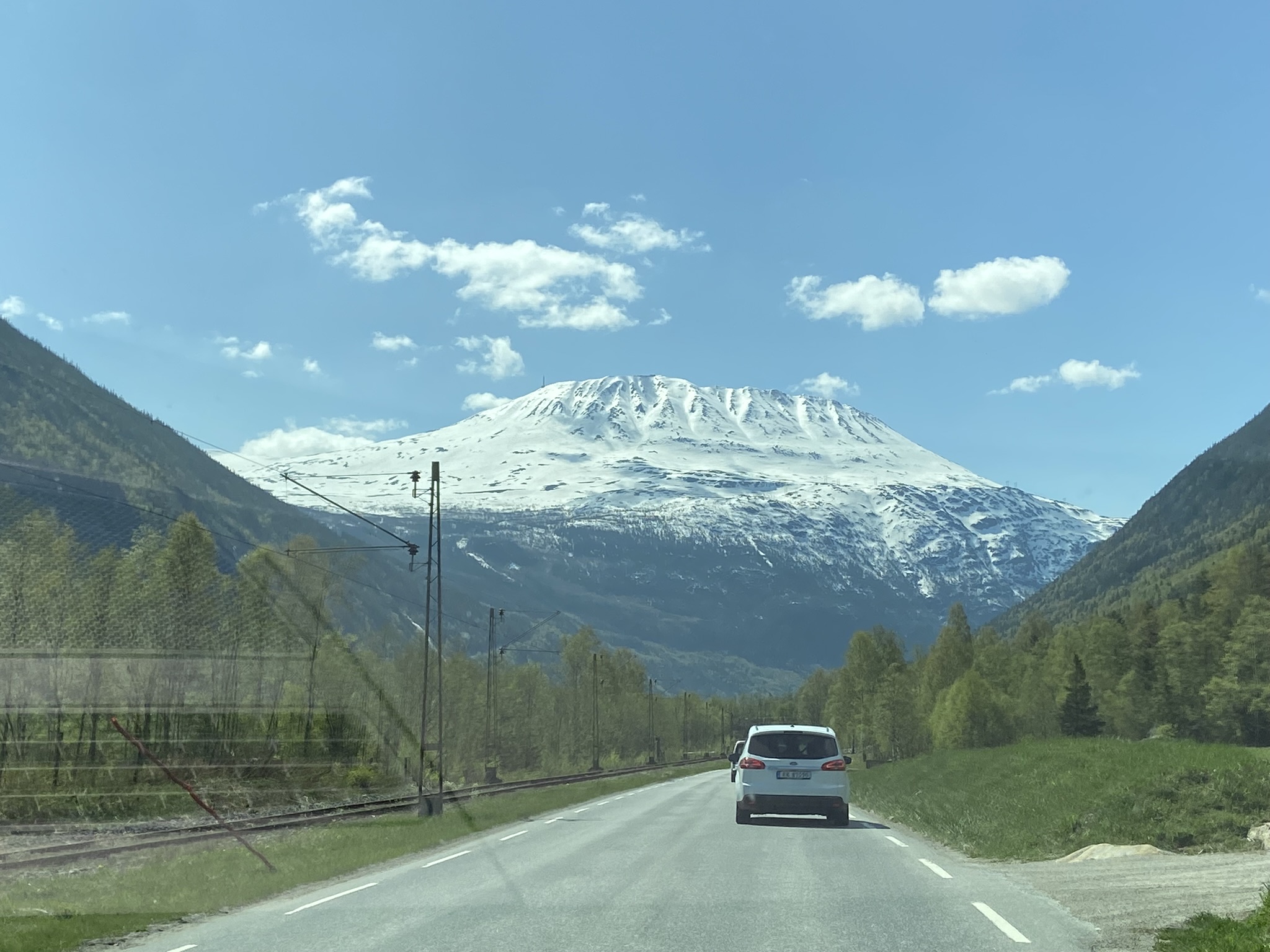
When GTop, as he's affectionately known, finally reveals his snowy crest I subconsciously release an audible gasp. I'm struck not only by his enormous stature but his singularity - a stoic standing alone, towering over his arboreally endowed neighbors with an unshakable equanimity.
While nowhere near the top of the list of highest peaks in Norway (which are mostly located on the west coast, vestiges of the Caledonian Orogeny, i.e. the mountain building event that gave us the Appalachians & Scottish Highlands), GTop is one of the most visited (if not the most) given its breathtaking views and proximity to Oslo.
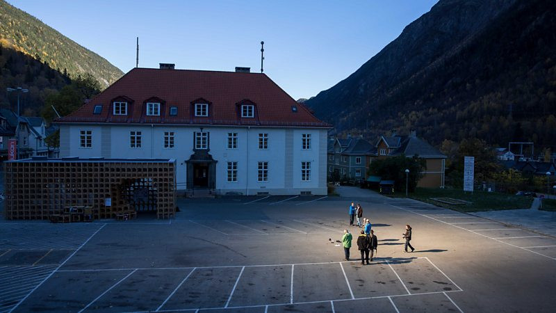
As we approach the mountain Sondre tells me about Rjukan, a small town nestled in the northern shadow of GTop. The town was essentially built from scratch during the construction of a fertilizer plant by Norsk Hydro in the early 20th century. At the time of its completion in 1911 the Vemork hydroelectric power plant was the world's largest hydroelectric power plant, larger even than the hydro plant at Niagara Falls. The plant was also the site of Norwegian heavy water sabotage operations during WWII - an effort to thwart the German's plant to build an atomic bomb (although the Nazis were hoist with their own petard by instigating the exodus of their top scientists starting in 1933).
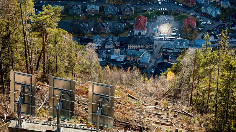
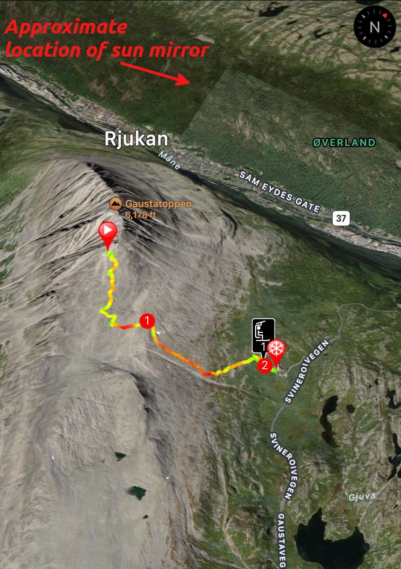
And when I say the town sits in the shadow of Gaustatoppen I mean it. Literally. Every winter, from September to March their mountainous compadre completely blocks the sun at all hours of the day. In 2013 local artist Martin Andersen erected a series of mirrors connected to a sun tracker to render the town square awash in bright, beautiful sunshine during these dismal months. According to the town's mayor, “the sun mirror means a lot to Rjukan... It’s a perfect combination of technology and art – and of course it is a great welfare activity for the citizens of Rjukan.”
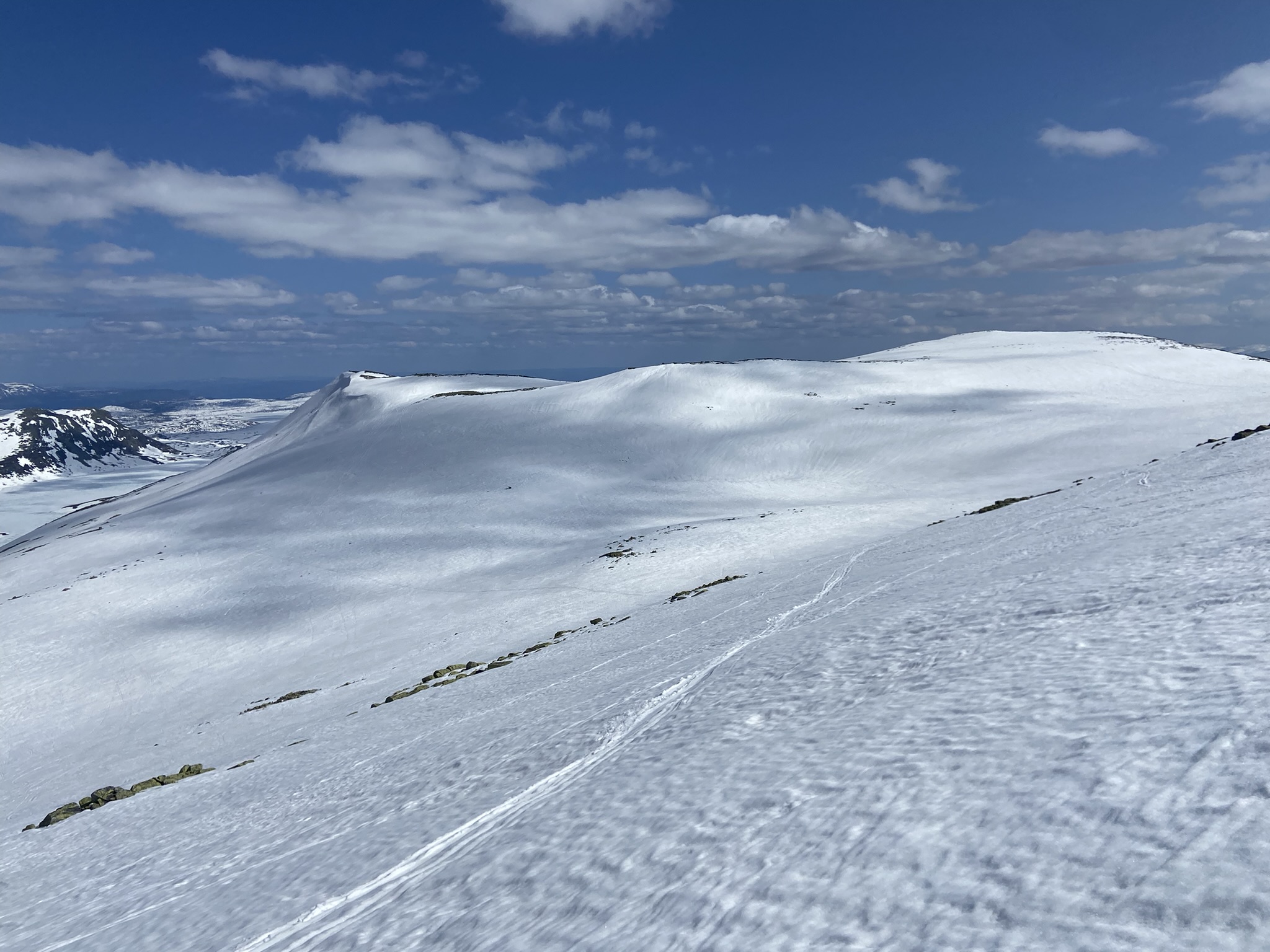
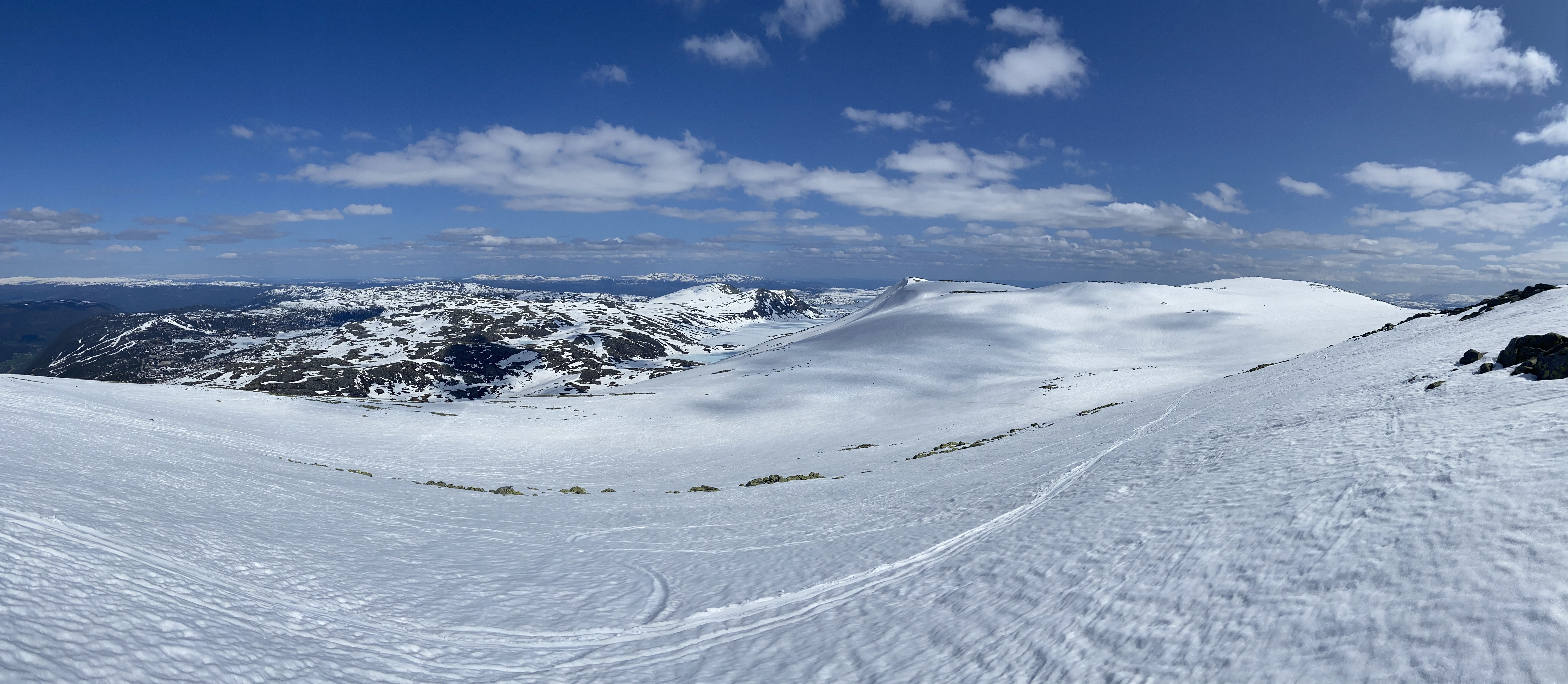
As we wind our way up the Northeastern flank of GTop towards Chalet Bratlie I spot lines of chairs, strung aloft, sitting idly, softly waving in the breeze. Seeing as we're nearly into June the chairlifts of Gausta Skisenter stopped spinning weeks ago. However, GTop still accommodates a blanket of snow upon his lofty ridge and by god I feel like sliding down it. Thankfully we are in luck - we can catch a ride to the top of the mountain - but it won't be on a chairlift. Or a T-bar. Or a rope tow.
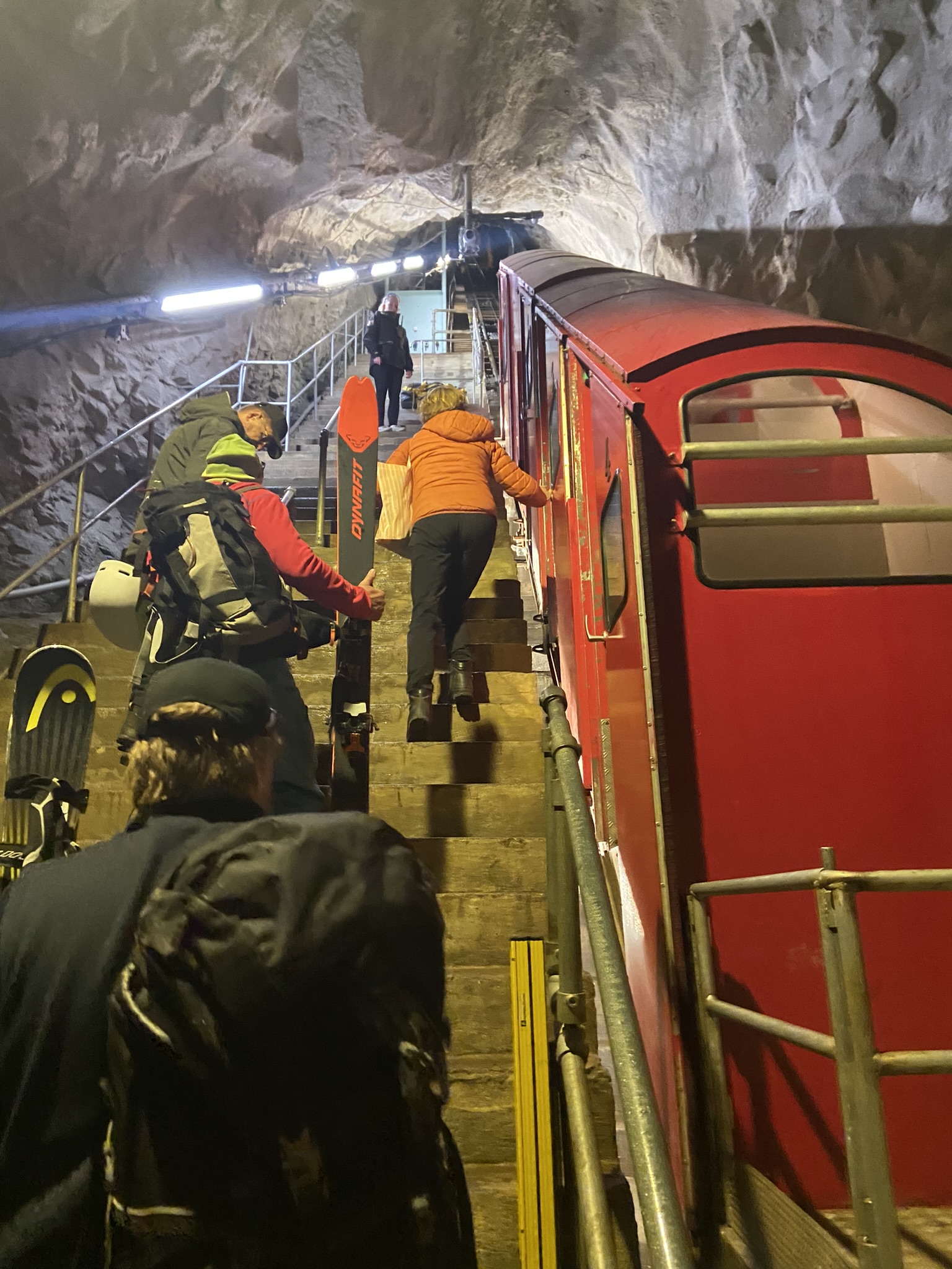
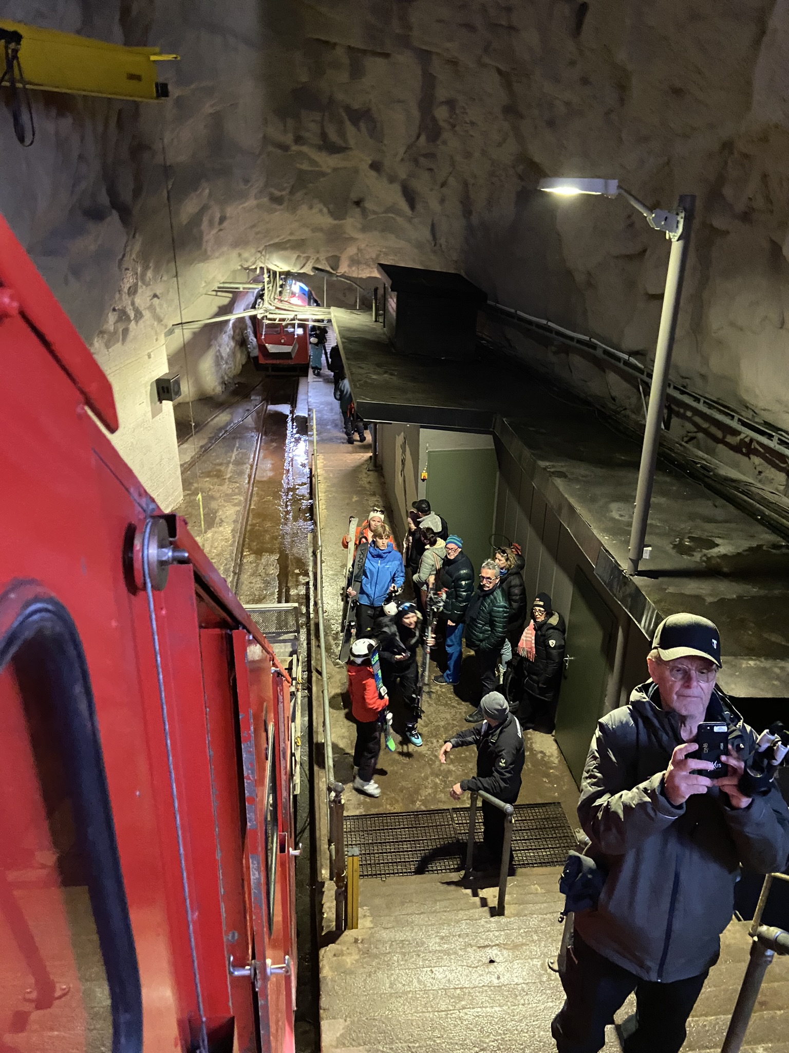
No sir, we're going to ride a tram up the inside of the mountain.
Gaustabanen
In 1953 Telemark County authorities announced plans for a tunnel tramway to ferry tourists to GTop's heavenly summit for sightseeing and to cater to the ever growing popularity of alpine skiing. The project was initially planned as a joint venture between local municipalities eager to capitalize on increased tourism and NATO eager to establish a monitoring and communications center to keep tabs on the Soviets. However, as you can imagine, the operation was quickly subsumed by the military brass at NATO, strong-arming their way to sole ownership and leaving the public in the lurch.
For nearly 60 years the GTop tram was closed to the public, available only to military personnel and civilians with the highest security clearance. Finally, on 31-July 2010, a dream decades in the making was finally fulfilled when the first tourists climbed aboard a summit-bound tram car.
Sondre and I climb onto the first stage of the tram, which lumbers a half a mile horizontally into the mountain to the transfer point. Here we disembark and squeeze ourselves and all our gear into a funicular railway car with 4 of our new best friends. Claustrophobics not welcome. The funicular climbs a 39 degree grade 3/4 of a mile to the top of the mountain where we unfold ourselves from our temporary pretzelation.
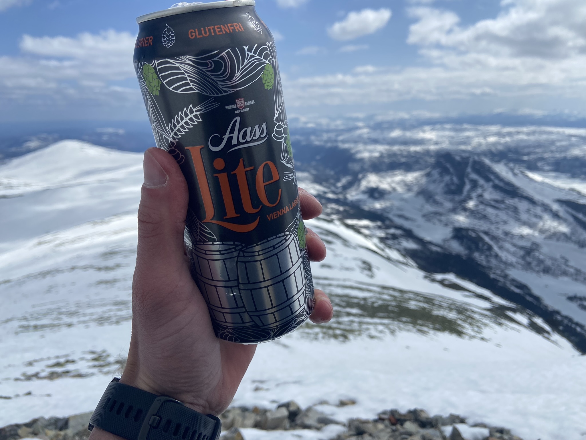
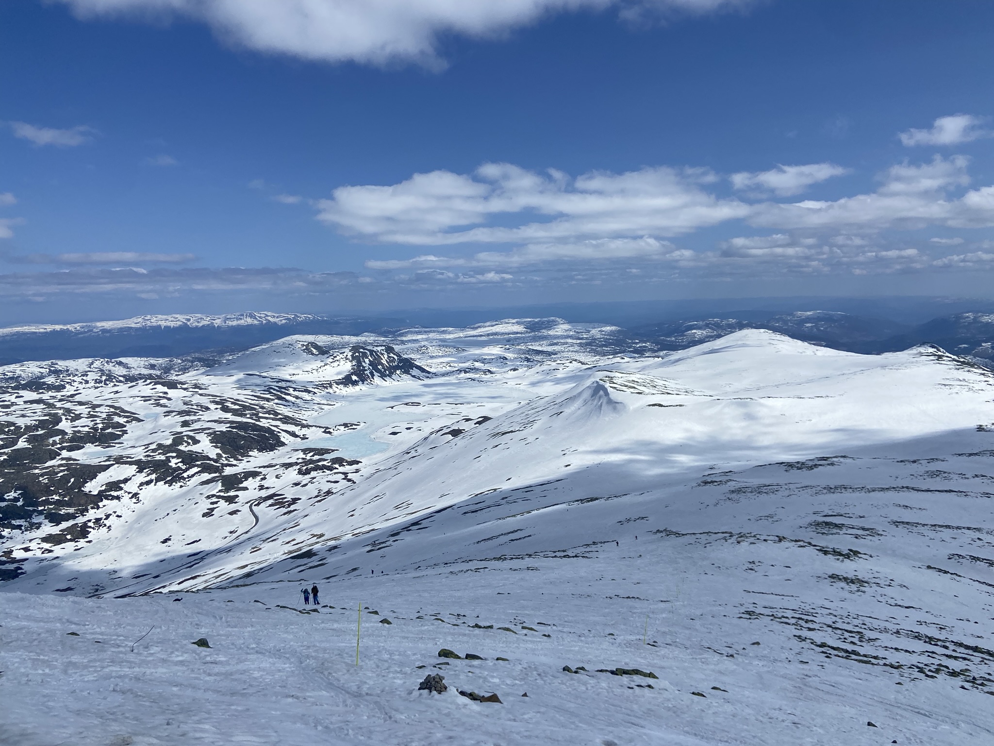
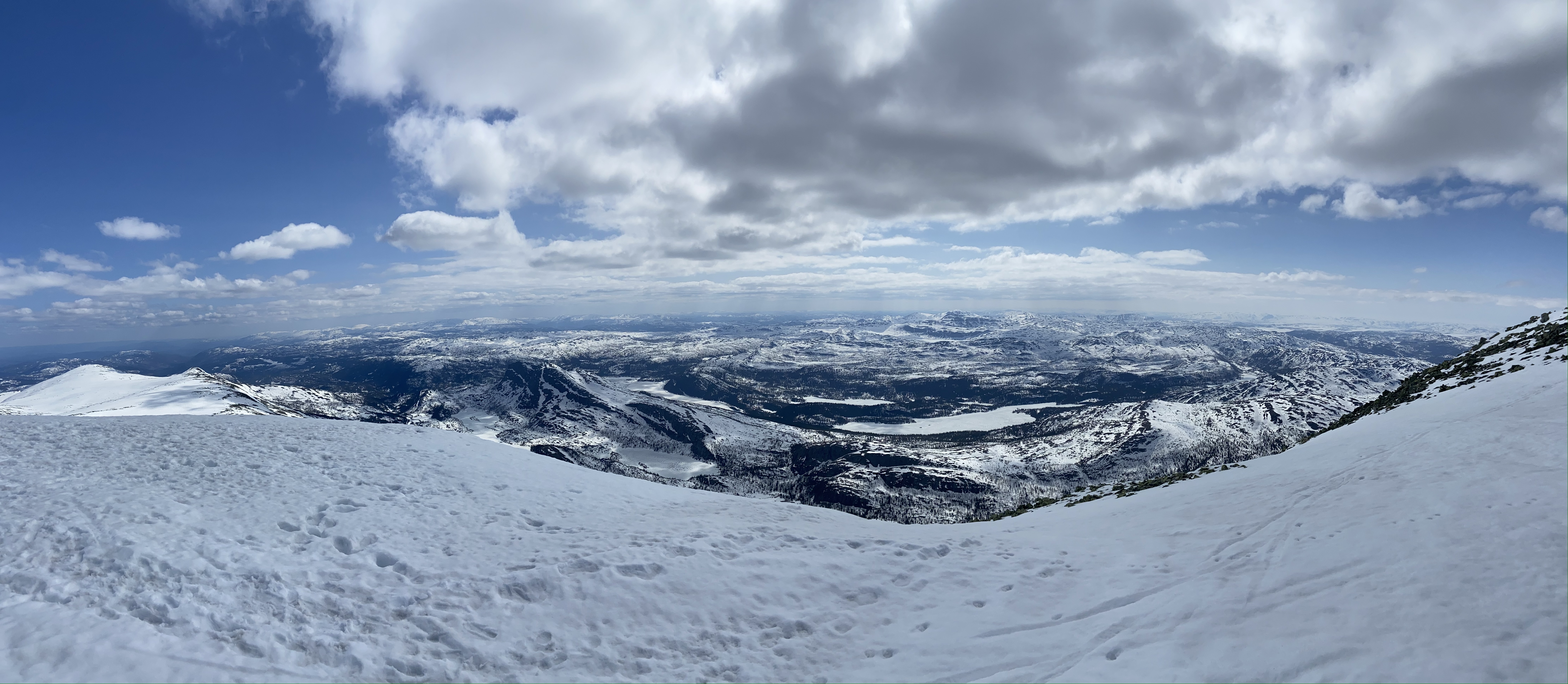
Upon GTop's zenith we soak in the magnificent views with a couple Aass Lite lagers packed for the occasion.
As we walk over to the NE cornice for a better view Sondre finds a soggy bit of snow and sinks up to his thigh. I make him wait to free his hoof before I snap a photo because it's just plain silly.
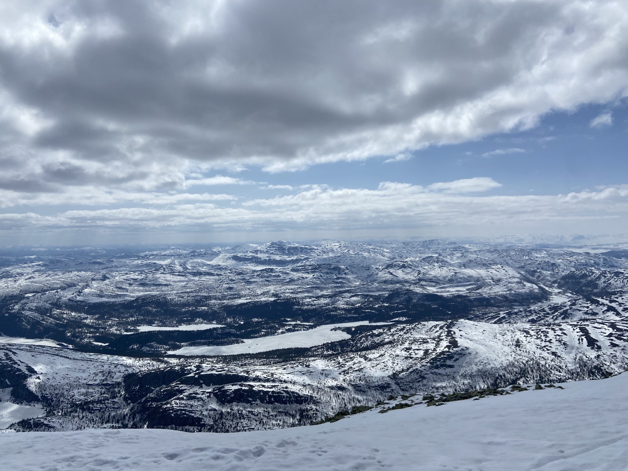
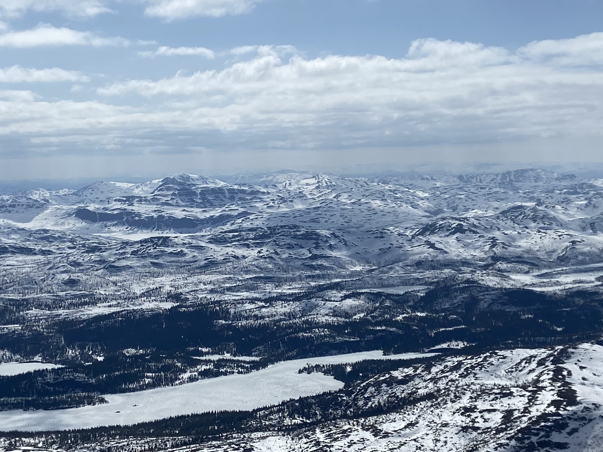
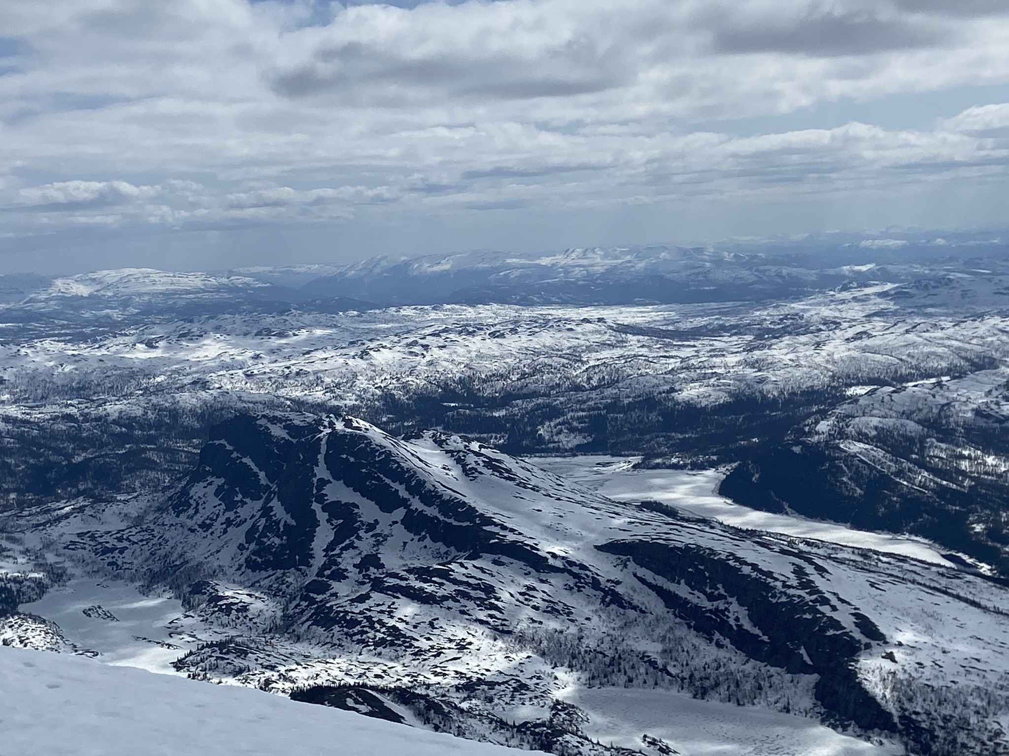
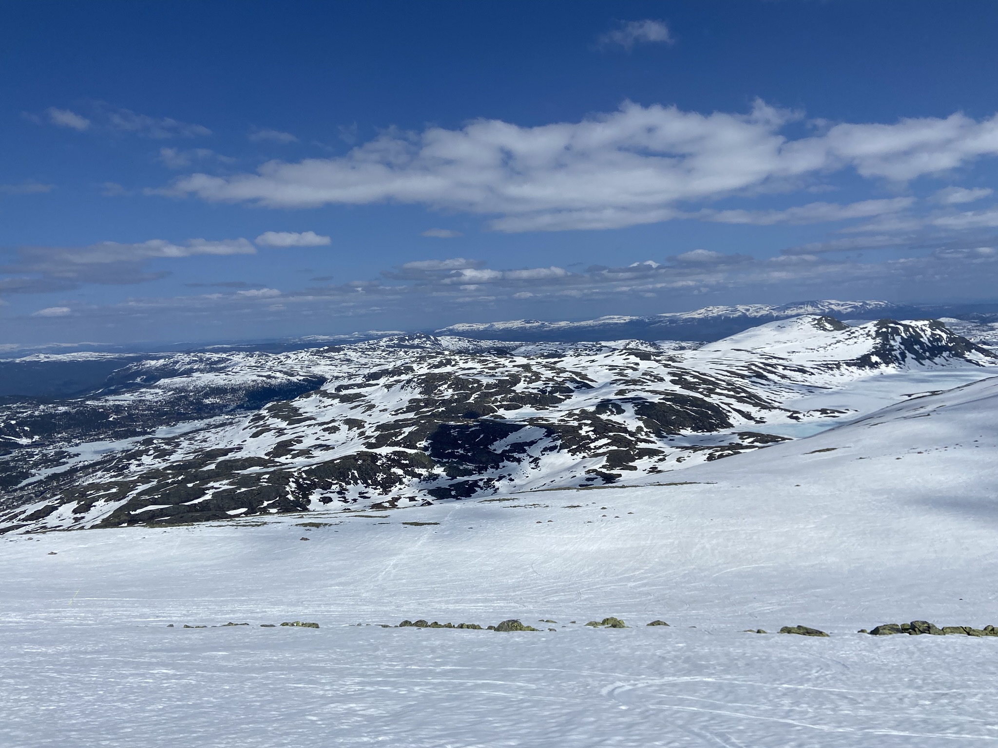
But the real reason I walked over to the cornice was to snap some amateur digital photos of the breathtaking scenery of Telemark County. According to westcoastpeaks.com, our vantage point offers a view of 50,000 square km (19,300 square miles), nearly 1/6th of Norway's entire mainland. The amount of god's green & white earth within our purview at this moment exceeds the entire landed area within the states of Maryland, Hawaii, and Massachusetts, and more than doubles the areas of Vermont, New Hampshire, New Jersey, Connecticut, Delaware, and Rhode Island. You could see a quarter of Oklahoma from up here. This must be what a tornado feels like.
Time to Send!!!
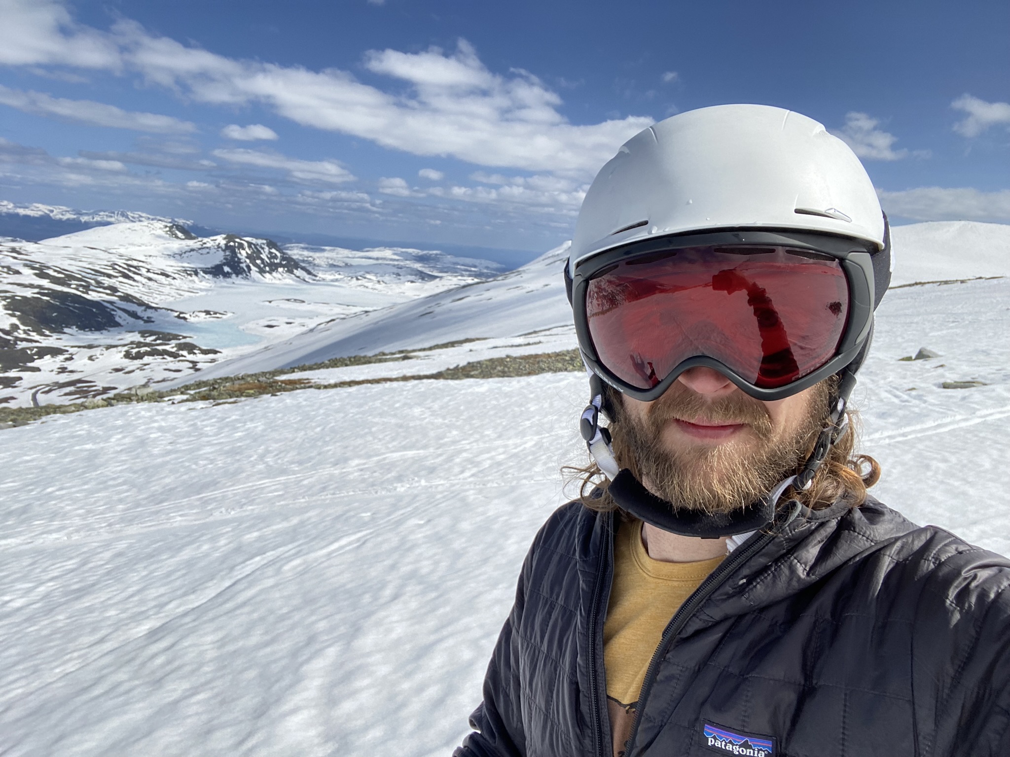
Once we've had our fill of the views and the Aass I strap on my (Sondre's brother's) gear and point my (Sondre's brother's) skis downhill.
The boots don't fit
The skis feel weird
The snow is sloppy
It's marvelous
It's skiing... In May... In Norway...
There is nobody on the planet who is having a better time than I right now.
The first half of the run takes us along the mountaintop spine before we pivot our planks down the fall line towards the Skisenter. The entire run takes 15 minutes - a full day of planning, driving, and schlepping gear for 15 minutes of recreation. But that's just fine by me.
Because the après is the real reason we love skiing, right?

Yep, totally worth it.